Here are the GPS coordinates for the Razorback Riders campground: N35 47.725 W93 50.461
From the North/West:
Take exit number 62 East from I-540 in Fayetteville, AR. It will be called Hwy 62, but is also Hwy 16. Follow the signs for 16, it will zig and zag a bit through town. It will go south on Razorback Rd, and then east again on McNair. Follow 16 about 30 miles from I-540, to Combs. Just after leaving Combs, you'll take the next road to the south (right). It will turn into gravel. Follow it about 2 miles until you see a large open area down the hill on your left with a green roofed club house, gravel RV strips, etc. That's the camp. Enter the gate and down the concrete drive into camp.
From the South/East:
From I-40, take exit 35 onto Hwy 23 North. This is also called the Pig Trail and is very scenic, but also very twisty and hilly. So take your time, especially north of Cass. Take 23 to Hwy 16, where you'll go West, or left. Go about 2.3 miles until you cross a small bridge over Mill Creek. Turn left (south) right after the bridge (if you reach the town of Combs, you've gone about 1/4 mile too far). The road will turn into gravel. Follow it about 2 miles until you see a large open area down the hill on your left with a green roofed club house, gravel RV strips, etc. That's the camp. Enter the gate and down the concrete drive into camp.
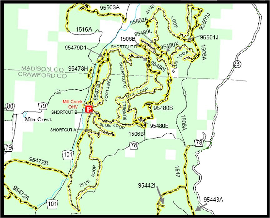
This map of the riding area shows the main loops. The camp area is just a little north of where the map starts, but we will access the trails right from camp.
RV's will fit eaily into the camp area and there should be electric/water sites available for $30 for the event on a first come, first served basis. We also have a dump station in the camp.