Jim Cook gave me directions from Bismarck/TR trails over to Lost Creek, for anyone wanting to go the MX track. Take 84 West from Bismarck. Go 12 miles to Deer Park Road and turn right. Go about 100 yards (I think it's a left) onto Dearman Road which is gravel. That road runs into Lost Creek.
Apparently there's a gate at a 90 in the road. EVERYONE entering the Lost Creek facility must sign a release even if you're not riding there.
There are three gas stations in Bismarck and two more between Bismarck and Lost Creek. Lost Creek has camping but doesn't have any RV hookups but they can help with the water if you have a holding tank. It is about 15 miles or so to Bismarck where the Train Tobber trail is located. Stores are within 15 miles and Lost Creek has plenty of firewood.
Brock Creek riding area directions
This is a start at the directions, at least. I shamelessly stole these off the AHSCS (Ark Hare Scrambles Championship Series) website.
Map to the town of Jerusalem, Ark. This is the jumping off spot for the road into Brock Creek. I-40 in the bottom of the picture is the stretch between Ft. Smith and Little Rock.
Zoomed in map of the town of Jerusalem, Ark.
Trailhead map. You are here!
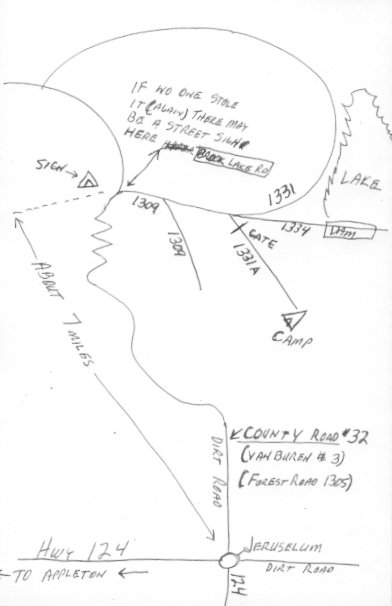
Hand drawn map of the dirt road leading back to the riding area. Do NOT believe the camp designation yet. I still need to figure that out. But this will give you a good idea of where the riding area is. I'm suppose to go riding there for the first time later this month so I'll try to get GPS coordinates, etc and post them.
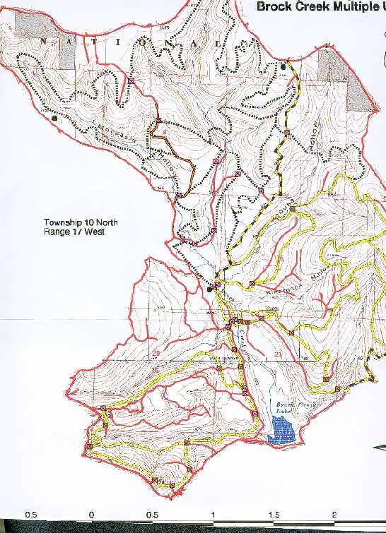
Trail map.
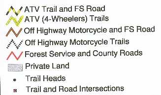
Trail map legend.