Here are the GPS coordinates for the camp area we'll be using: N35 32.004 W92 48.034
Here are the GPS coordinates for Jerusalem: N35 24.289 W92 49.069
From the West to Jerusalem:
I take I-40 to exit 83. This is a brand new exit and may not be on many maps but it's the next one east of Exit 81. Take a left (north) on 326 for about 3/4 of a mile to a Tee at a gas station.
That gas station at that Tee is one of the last ones you'll see so fuel up, ice up, etc if you need to. Take a right at the Tee onto 124 (east). Follow that to Jerusalem but watch carefully for the split from 105 about halfway over. In Jerusalem, take a left (north) on Jerusalem road. There will be a closed, broken down old gas station on your right.
From the East to Jerusalem:
I'm not as sure here as I've never gone this way. I'll change this if someone wants to corrects me.
Take exit 107 from I-40. Go right (north) on 95 to just past Wonderview. Take 124 to the left (west) from Wonderview and follow it to Jerusalem. Go straight through Jerusalem. The directions below are from the intersection where 124 turns due west. There is a closed, broken down old gas station on your left at that intersection. You will go straight (north) from there onto Jerusalem road.
From Jerusalem to the camp:
Jerusalem Rd will quickly turn into a dirt road that you'll follow for approx 6.1 miles to a 3 way intersection. I should have orange and black Moose arrows from this intersection the rest of the way to camp so look for those. You will stay left at that intersection, staying on Jerusalem road. Stay left at the next intersection, approx 4.2 miles further. Stay right at the next 2 intersections, which are .8, and then .4 miles further on. The road name may change to NF-1307 at some point.
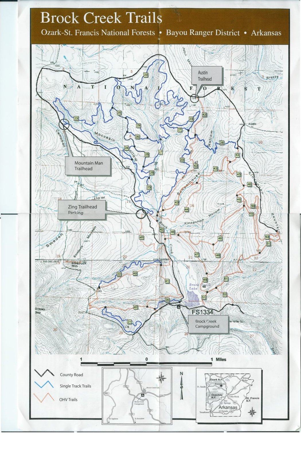
Go 3 miles past the last intersection. You'll be looking for a small trailhead on the right. It's called the Austin Trialhead and will have trail #42 going south from it. It should be at GPS coordinate N35 29.022 W92 49.211. Follow trail #42 south from the trailhead (which is an ATV trail/forest service road) approx 1/4 mile to the camp area on the left.
This map of the riding area should help.
RV's will not fit back in the camp area. I'm leaving mine at home this year, much to my and my wife's disappointment. Smaller Class C's might be okay down trail #42 but I sure wouldn't take mine in there. You're on your own if you try it. The trail/forest road is fairly flat but it's not terribly wide and has a couple of dips in it.
For RV's, there are not a lot of options. There are some deer camp clearings here and there along the road in. There is also a bigger open spot that would fit 2 big rigs just SE of the Zing Trailhead, on the map above. Otherwise, there is a bigger open area on the SE side of Brock Lake in the lower center of the map. I'm not talking about the "Brock Creek Campground" as that does not have space for any big rigs. Well, maybe one if you know how to do it but you don't want to get in there and find out it won't work or you'll have to back all the way back out. The spot I'm talking about is past the campground, across the dike, right on the other side of the lake. It'd be dicey if it was very wet.